Monthly Archive for March, 2012

National Walking Day April 4

From the American Heart Association, National Walking Day is coming up. On Wednesday, April 4, participate in a local noontime walk starting downtown at 1200 5th Avenue. More information below and at PugetSoundHeartWalk.org:

SEATTLE – The American Heart Association (AHA) has designated Wednesday, April 4, 2012 as National Walking Day in an effort to encourage more Americans to adopt active lifestyles and lower their risk for heart disease, the leading killer in the United States.

Walking has the lowest dropout rate for any physical activity, and walking for as little as 30 minutes a day can improve circulation, lower cholesterol and blood pressure, and promote weight loss, according to the AHA.

“We are proud to collaborate with the American Heart Association for National Walking Day,” says Ron Heller, Pacific Northwest Regional Executive for Union Bank, the sponsor for National Walking Day. “At Union Bank, we are committed to responsible banking and supporting total wellness in the communities we serve. On April 4, we are calling on Puget Sound companies to get involved by encouraging their employees to bring their sneakers to work and take a walking break during the day.”

Community Walks
The AHA and Union Bank will host a one-mile group walk in Downtown Seattle from the Union Bank branch at 5th and University Streets, noon – 1:00 p.m. Companies and individual walkers are invited to participate.

The Union Bank Everett Main branch, 332 SW Everett Mall Way, will also host a walk at noon for employees, area companies, and the public.

Seattle Parks and Recreation will host community walks at various locations as part of National Walking Day. For a list of locations and times, visit PugetSoundHeartWalk.org.

The City of Bothell is organizing a walk at noon for employees, area companies, and the public. The walk will begin at the police station parking lot, 18410 101st Ave. NE, and walkers will be provided water and snacks at the finish.

Organize Your Own Walk
Anyone can be part of National Walking Day by lacing up their sneakers and going for a walk. Companies and organizations that wish to promote fitness and organize group walks can find free resources at PugetSoundHeartWalk.org. Organizations with the highest participation in the small and large categories will receive the AHA’s Golden Tennis Shoe Award.

All individuals that walk 30 minutes will be entered to win Brooks shoes and a month’s supply of snacks from Popchips. Group walk coordinators must email information to king.walk@heart.org or individuals can enter from April 4 – 12 at PugetSoundHeartWalk.org.

Put Some heART in Your Step: Shoe Decorating Contest
Tap into your creativity and style up your shoe in honor of National Walking Day. Decorate a pair of tennis shoes any way you like, then take a photo and e-mail to king.walk@heart.org. Photos will be accepted from Saturday, March 24 through Saturday, April 7 and posted on the AHA’s Facebook page, Facebook.com/AHAPugetSound. Winners of the Put Some heART in Your Step shoe decorating contest will be selected on April 13 and will receive a new pair of Brooks shoes.

National Walking Day is part of the American Heart Association’s My Heart. My Life. healthy living initiative to help Americans achieve ideal cardiovascular health. To learn more, visit PugetSoundHeartWalk.org or call the local AHA at (206) 632-6881.

Share

Vote for the Worst Intersection in Seattle in 2012

The nominations are in and we have a large group of terrible places for peds, cyclists, and motorists who want to get around a safe and comfortable way. Here are this year’s nominees for the Worst Intersection in Seattle (click on images to see map):

  1. Pine St & Boren Ave near Capitol Hill Pine and Boren near downtown – “Dangerous for cyclists and remarkably unpleasant for pedestrians for an intersection that’s unavoidable for the commute of thousands of us.” (nominated by Hans Gerwitz)
  2. Queen Anne Dr / Raye St
    Raye St / Queen Anne Dr / 4th Ave N / 6th Ave N in Queen Anne – “This is a 6-way intersection, controlled by all-way stop signs, with no sidewalks, and is filled with cars. Completely chaotic atmosphere on foot or on a bicycle.” (nominated by Louis)
  3. Broadway Ave / Terrace St
    Broadway and Terrace St in Capitol Hill – “The crosswalk is NOT striped yet it is a busy intersection with people crossing to/from the #9 bus stop for Harborview. Lots of elderly folks too … and drivers WILL NOT STOP for people crossing because they are in too much of a hurry to make the light at Broadway/Boren.” (nominated by Gordon Werner)
  4. 5th Ave / Denny Way
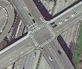
    5th Ave and Denny Way – “My vote is for 5th Avenue and Denny Way. Or as I call it, the 5th Avenue onramp.” (nominated by Ryan on Summit)
  5. Montlake / 520 Montlake and 520 – “It stinks no matter what your mode of transportation. Crowded roads, terrible pavement, many crossings.” (nominated by Mike)
  6. Eastlake Ave / Harvard Ave Eastlake and Harvard – “The trip north isn’t so horrible (relatively speaking), but going south over the University Bridge, then quickly merging into traffic and across two lanes is nightmarish. Cars are dodging backed-up left-turn traffic at Fuhrman, bicycles are moving fast on the downhill with visibility limited by the bridge, and the street is a torn up mess. At least most of the grit from after the snow has been cleared out of the bike lane.” (nominated by Jason)
  7. 15th Ave / John St
    15th Ave and John St – “This intersection is rather bizarre as the street grid on either side of 15th Ave doesn’t match up. John and Thomas (on the other side of 15th) are rather busy arterials that carry two of Metro’s busiest bus routes (8 & 43) plus a huge amount of cars trying to access the neighborhood and Group Health. Typically cars trying to go east to west have to make a right turn on the red light at 15th onto John try speeding around the corner while pedestrians have a walk signal.” (nominated by Chris Mobley)
  8. 37th Ave / Lake Washington Blvd / Harrison St
    37th Ave E & Lake Washington Blvd & E Harrison St – “No crosswalks or other clear intersection markings, limited visibility for and of cars coming up the hill on Lk WA Blvd, most cars speeding. This might seem like an intersection in the boonies, but this is the flattest way to get from Madrona and Leschi to the Montlake Bridge or University Bridge.” (nominated by Maggie)
  9. 35th Ave and Avalon Way 35th Ave SW & Avalon in West Seattle – “Terrible for walking and biking. It has heavy traffic, no bike lanes, badly marked crosswalks, and there has been no sidewalk on the southeast corner for several years.” (nominated by Peter)
  10. 15th / Beacon Ave 15th and Beacon Ave in Beacon Hill – Long light cycles and long crossing distances make for an intersection worth avoiding if you can. (nominated via Twitter by @BeaconBIKES, commentary by Troy)
  11. Lafayette / Spokane Lafayette Ave and Spokane St – Would be a perfect way to access Jefferson Park from the residential area, except there are four lanes of speeding traffic to cross, there is no marked crosswalk, and there is no sidewalk on the south side of the street. (nominated via Twitter by @BeaconBIKES, commentary by Troy)

[poll id=”15″]

Note: Poll will close on April 1st.

Share

Walking news roundup

There’s a lot of news out there to cover – here are a few stories:

And a couple SDOT news releases that I don’t have links for:

  • “Seattle Department of Transportation’s Roadway Structures crew will construct a new staircase near the southeastern city limits at 72nd Avenue South between Rainier Avenue South and South Taft Street.” The stairway will be closed starting next Monday through early May. “The new staircase will be wider with hand rails on both sides, and will sport a new bike runnel making it easy to roll a bike up and down the stairs.”
  • “Repairs are underway on the Duwamish Trail in West Seattle. The asphalt trail has been heavily damaged in places by tree roots and needs to be repaired for bicyclist and pedestrian safety.”
  • NE Ravenna Blvd between Green Lake and 15th Ave NE will be repaved. “Work includes grinding and removing the existing asphalt roadway, repairing areas of the concrete roadway base, repaving, upgrading pedestrian curb ramps and building a curb bulb at E. Green Lake Drive N. and N.E. 71st Street. Work is expected to be completed by the end of summer, dependant on weather conditions.”
  • Also, the pedestrian paradise known as the Ballard bridge will have a closed west sidewalk starting next Monday and continuing into April due to a painting project.

One final thing – the nomination period for the worst intersection in Seattle ends this Sunday.

Share

Nominate your worst intersection in Seattle in 2012

Nominations have been received – you can vote here

It’s time to submit your nominations for worst pedestrian intersection in Seattle. Last year you all voted Aurora Ave and John/Thomas/Harrison/Republican as the worst intersections in Seattle.

Go ahead and comment on this post to submit your nomination and tell us why it’s the worst. The criteria for “worst” intersection is your own – this could be an intersection with poor signaling, missing sidewalks, safety issues, and maybe is one you have to use every day.

The deadline for nominees is March 18 and after that we’ll put the most-nominated spots up to a vote.

Share

Road diet on Nickerson found to improve safety, will other streets get a road diet?

SDOT has released a report on the Nickerson St road diet and found that by reducing the number of lanes for cars, safety has improved. Collisions, overall vehicle speeds, and the number of speeders have been reduced with minimal impact to traffic volumes. The Mayor outlines the good news:

Completed by the City in August 2010, the modifications have produced the following results:

  • Reduced collisions by 23 percent over a one-year period (compared to the previous five-year average)
  • Motorists traveling over the speed limit have declined by more than 60 percent
  • Top-end speeders (people traveling 10 or more miles over the speed limit) have fallen by 90 percent
  • The 85th percentile speed dropped from 40 mph and 44 mph westbound and eastbound to 33 mph and 33 Westbound and Eastbound. This is an 18 and a 24% reduction in speed.
  • Traffic volumes remain roughly the same with no evidence of traffic diversion.

This is the 27th successful road diet implemented by SDOT since 1974. And, with yet another roadway safety measure in place, the question must be asked: why isn’t SDOT implementing more of these safety measures?

We recently pointed out that 28 pedestrians have died in locations that may be eligible for a road diet. Since then, we’ve profiled three streets that may be ideal candidates for SDOT to consider next: 35th Ave SW in West Seattle, 23rd Ave in the Central District / Judkins Park, and S Jackson St in the International District. Let’s compare these three streets with Nickerson St to see whether these other streets may deserve the same successful safety treatment as Nickerson and 26 other Seattle streets.

First, we’ll start by looking at traffic volumes. SDOT looks at the total number of cars that use a roadway before implementing a road diet. Streets with average daily traffic counts above 25,000 are not good candidates, and presumably lower volumes make for better candidates, though road diets have minimal impact on overall volume. Using SDOT’s 2010 traffic volumes, here are the four streets compared, from lowest volume to highest:

  1. Jackson St: ranges from 10,200-13,600
  2. 23rd Ave: 13,400
  3. 35th Ave SW: ranges from 16,100-22,700
  4. Nickerson St: 22,300

Let’s look at another metric. While Walk Score is not an official criteria used by SDOT, it indicates the walkability of a location and is correlated with the number of pedestrians in an area. Streets with more pedestrians may be more deserving of measures that make the pedestrian environment safer and more pleasant. We took a sample Walk Score of 2-3 locations along each of these streets and are ranking them from highest (most walkable) to lowest (least walkable).

  1. Jackson St: 90
  2. 23rd Ave: 86
  3. Nickerson St: 81
  4. 35th Ave SW: 75

While the last two comparisons were interesting, the primary purpose of a lane rechannelization is to improve safety and the most dangerous streets should be looked at the hardest. We looked at this map of nationwide road fatalities, and counted the deaths that have occurred on each of these roadways from 2001-2009 to rank them in terms of urgency for safety improvements:

  1. 35th Ave SW: 4 roadway fatalities (including 2 dead peds)
  2. 23rd Ave: 4 roadway fatalities (2 dead peds)
  3. Jackson St: 3 roadway fatalities (3 dead peds)
  4. Nickerson St: 1 roadway fatality (0 dead peds)

Of our comparison group, Nickerson St has been the safest, is the second least walkable, and has the highest traffic volume. Still, a road diet was implemented and now has been shown to be a success. If a road diet can work there, then surely it can work on these other streets. How many more people will have to die before SDOT implements road diets on 35th Ave SW, 23rd Ave, Jackson St, and other locations where people are killed on Seattle’s roads?

Share